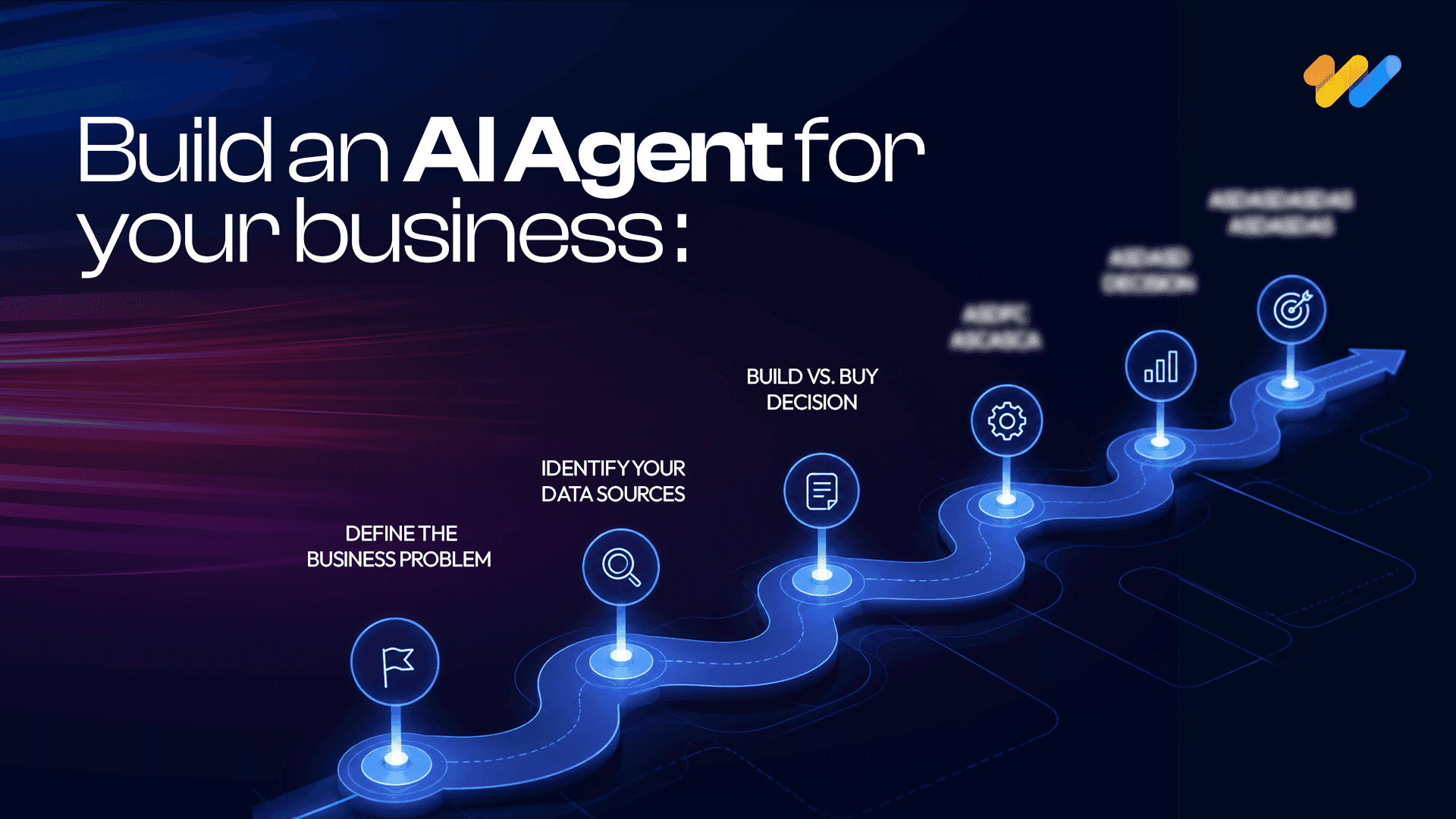
Agentic GeoAI: AI Agents Transforming Enterprise GIS Workflows (2026)
A flood warning is issued. By the time analysts collect satellite imagery, run spatial models, validate results and distribute reports, the situation has already changed. Similar delays occur during wildfire response, infrastructure failures and disaster recovery, where decisions often depend on how quickly geospatial information can be transformed into actionable insights.
Agentic GeoAI addresses this challenge by introducing AI agents that can plan, reason and execute complex geospatial workflows with minimal human intervention. Instead of simply generating outputs, these agents automate spatial analysis, coordinate tasks across enterprise GIS systems and support faster, more consistent decision-making.
By combining large language models, geographic reasoning and enterprise geospatial platforms, Agentic GeoAI enables intelligent spatial workflows while maintaining human oversight for governance and accuracy.
In this blog, we explore how Agentic GeoAI works, the technologies behind it and how it is reshaping enterprise spatial intelligence.
How Agentic GeoAI Differs from Traditional GeoAI?
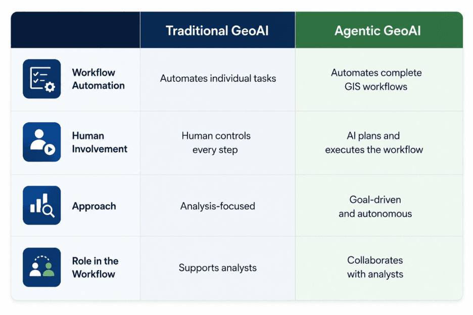
Enterprise GIS has evolved through four distinct stages, with each generation introducing greater intelligence and automation.
Traditional GIS relied entirely on human analysts. Every step, from collecting data and running spatial analyses to creating maps and reports, required manual execution using GIS software.
GeoAI introduced machine learning and deep learning to improve tasks such as image classification, feature extraction and predictive spatial analysis. However, these AI models remained task-specific and still depended on users to initiate and coordinate workflows.
Agentic GeoAI represents the next stage of evolution. Instead of assisting with individual GIS tasks, AI agents can plan, coordinate and execute complete geospatial workflows. They retrieve data, select analytical methods, generate maps, produce reports and interact with other enterprise systems while keeping humans involved for oversight and approvals.
The next step is Autonomous Geospatial Systems, where multiple AI agents continuously monitor spatial data, respond to changing conditions and optimize workflows with minimal human intervention. Although many of these capabilities are still emerging, advances in AI agents, real-time geospatial platforms and digital twins indicate the direction enterprise GIS is heading.
This progression reflects a broader shift from human-operated GIS to AI-assisted GIS, then to AI-orchestrated workflows, and ultimately to autonomous geospatial operations.
Why Traditional GIS Workflows Are No Longer Enough?
Modern GIS platforms are more powerful than ever, yet many enterprise workflows remain largely manual. Analysts still spend considerable time locating datasets, integrating multiple data sources, running geoprocessing tools, validating outputs and preparing reports before meaningful insights can be delivered. As spatial data volumes grow and decision cycles become shorter, these traditional workflows struggle to keep pace.
The challenge extends beyond manual effort. Organizations often face analyst bottlenecks, where advanced spatial analysis depends on a limited pool of GIS specialists. At the same time, disconnected tools across GIS platforms, satellite imagery, databases and reporting systems create fragmented workflows, while coding dependency makes advanced automation inaccessible to many business users. As the volume of Earth observation data continues to grow beyond what can be efficiently managed using local systems, organizations are increasingly adopting cloud-native geospatial workflows and AI-driven automation to keep pace. Even after the analysis is complete, static reporting means insights can quickly become outdated as new spatial data becomes available.
These limitations are driving the transition to AI-driven GIS. Instead of executing every step manually, organizations can define a business objective while intelligent systems retrieve data, perform autonomous spatial analysis, generate maps and produce reports with minimal intervention. This shift lays the foundation for Agentic GeoAI, where AI agents’ complete workflows rather than simply assisting with individual GIS tasks.
From Single Agents to Multi-Agent GIS Systems
As location-based workflows become more sophisticated, a single AI agent is no longer sufficient to manage complex GIS operations. Modern GIS platforms increasingly rely on multi-agent systems, where specialized AI agents collaborate to improve scalability, accuracy and operational efficiency.
A typical system includes agents for mapping, routing, imagery analysis, risk assessment, reporting and continuous monitoring. A central planning agent orchestrates these specialized agents by assigning tasks, managing data exchange and combining their outputs into a unified workflow.
For example, during a flood response, the Imagery Agent identifies affected areas, the Risk Analysis Agent estimates impacts, the Routing Agent generates evacuation routes, the Mapping Agent visualizes the results and the Reporting Agent produces a situational report. By working together, these agents deliver faster, more accurate and context-aware insights than a single AI agent operating independently.
How Geospatial AI Agents Actually Work?
Unlike traditional GIS software, AI agents automate end-to-end workflows. Users define a business objective and the AI translates it into coordinated tasks using GIS tools, spatial data and reasoning models.
The agent plans the workflow, discovers relevant datasets, performs geographic assessment, applies spatial reasoning and generates maps, visualizations and reports. Before any critical action is taken, human experts validate the outputs to ensure accuracy, governance and compliance.
By ochestrating these steps, AI agents transform traditional mapping and analysis into intelligent, scalable workflows that deliver faster and more consistent outcomes.
The Building Blocks of Agentic GeoAI
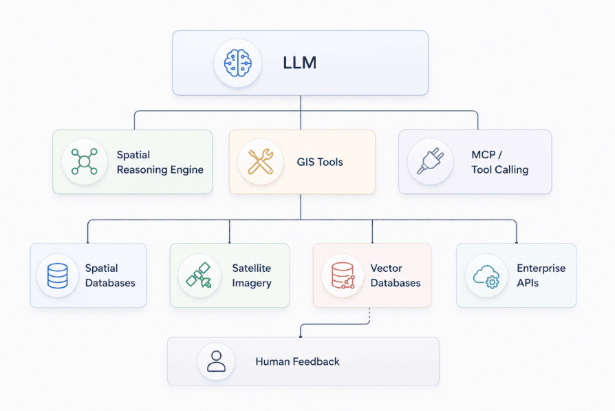
At the core of Agentic GeoAI is a layered architecture that combines AI reasoning, enterprise GIS and connected data ecosystems.
Intelligence
The LLM serves as the orchestration layer, interpreting user intent and coordinating workflows, while the Spatial Reasoning Engine adds geographic context by evaluating topology, proximity, connectivity, terrain and other spatial relationships.
Execution
GIS tools perform core spatial operations, while Model Context Protocol (MCP) enables AI agents to securely connect with GIS software, enterprise APIs and external services to automate end-to-end workflows.
Data
Spatial databases, satellite imagery and contextual knowledge sources provide the data required for accurate geospatial analysis and decision-making.
Enterprise Connectivity
Enterprise APIs integrate Agentic GeoAI with business systems such as ERP, IoT and asset management platforms, allowing spatial intelligence to support enterprise-wide operations.
Governance
Human feedback provides validation, strengthens governance and ensures AI-generated outputs remain accurate, transparent and compliant before critical decisions are executed.
Agentic GeoAI in Action
The true value of Agentic GeoAI lies in its ability to orchestrate complete GIS workflows rather than automate isolated tasks. By coordinating multiple data sources, analytical tools and AI-driven decision processes, AI agents enable faster, more accurate and context-aware outcomes across industries.
Disaster Response
Emergency agencies increasingly use AI, satellite imagery and GIS to support disaster response. Following major hurricanes and wildfires, organizations such as FEMA and the National Geospatial-Intelligence Agency (NGA) have used geospatial AI to rapidly assess damage, prioritize response efforts and improve situational awareness.
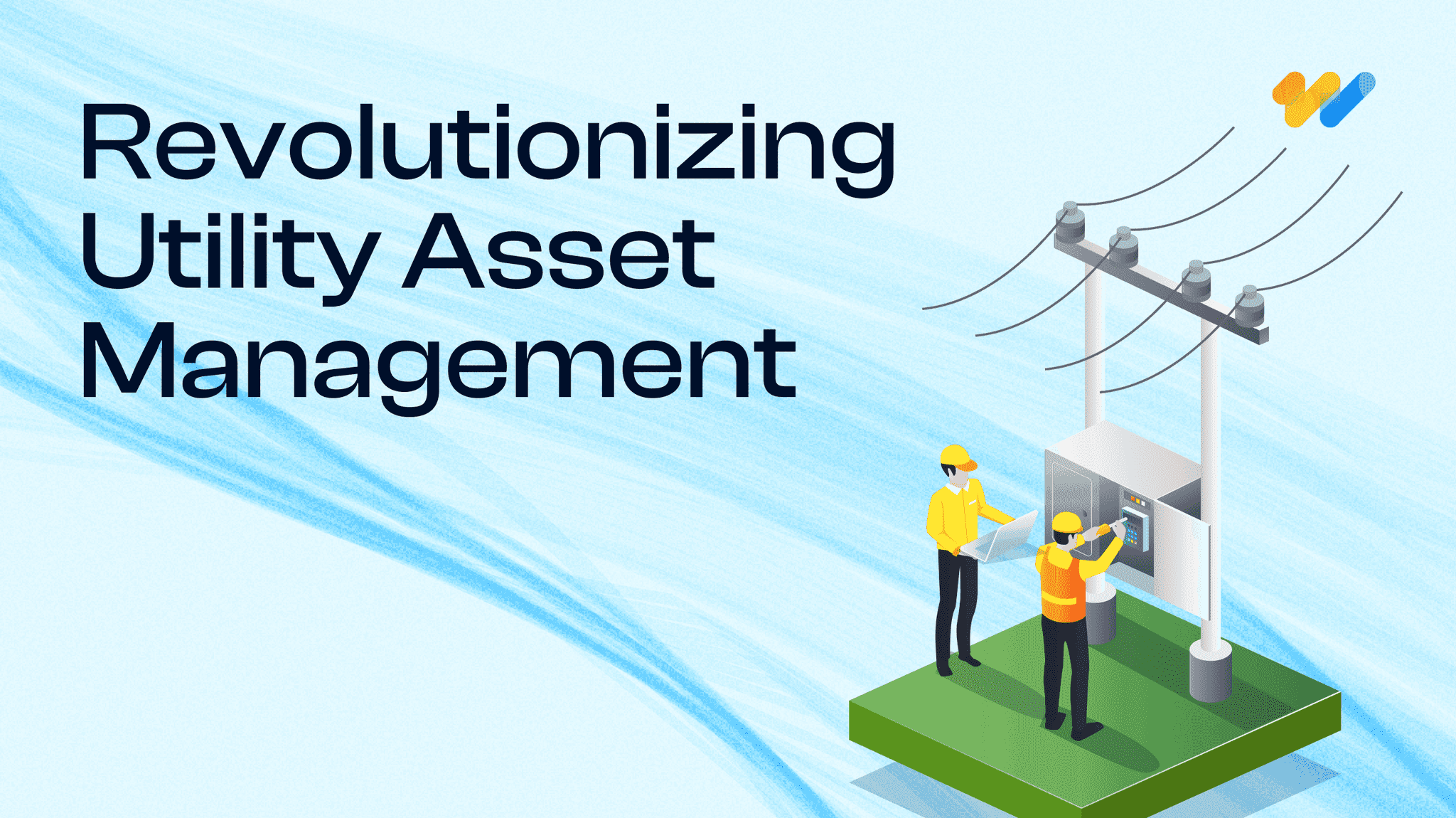
Utilities
Electric utilities are adopting AI and GIS to monitor grid assets, detect outages and optimize field operations. Companies including National Grid and Duke Energy have invested in AI-enabled inspection and asset management to improve infrastructure reliability.
Urban Planning
Cities including Singapore use AI, digital twins and geospatial data to support urban planning, evaluate development scenarios and optimize land use through data-driven decision-making.
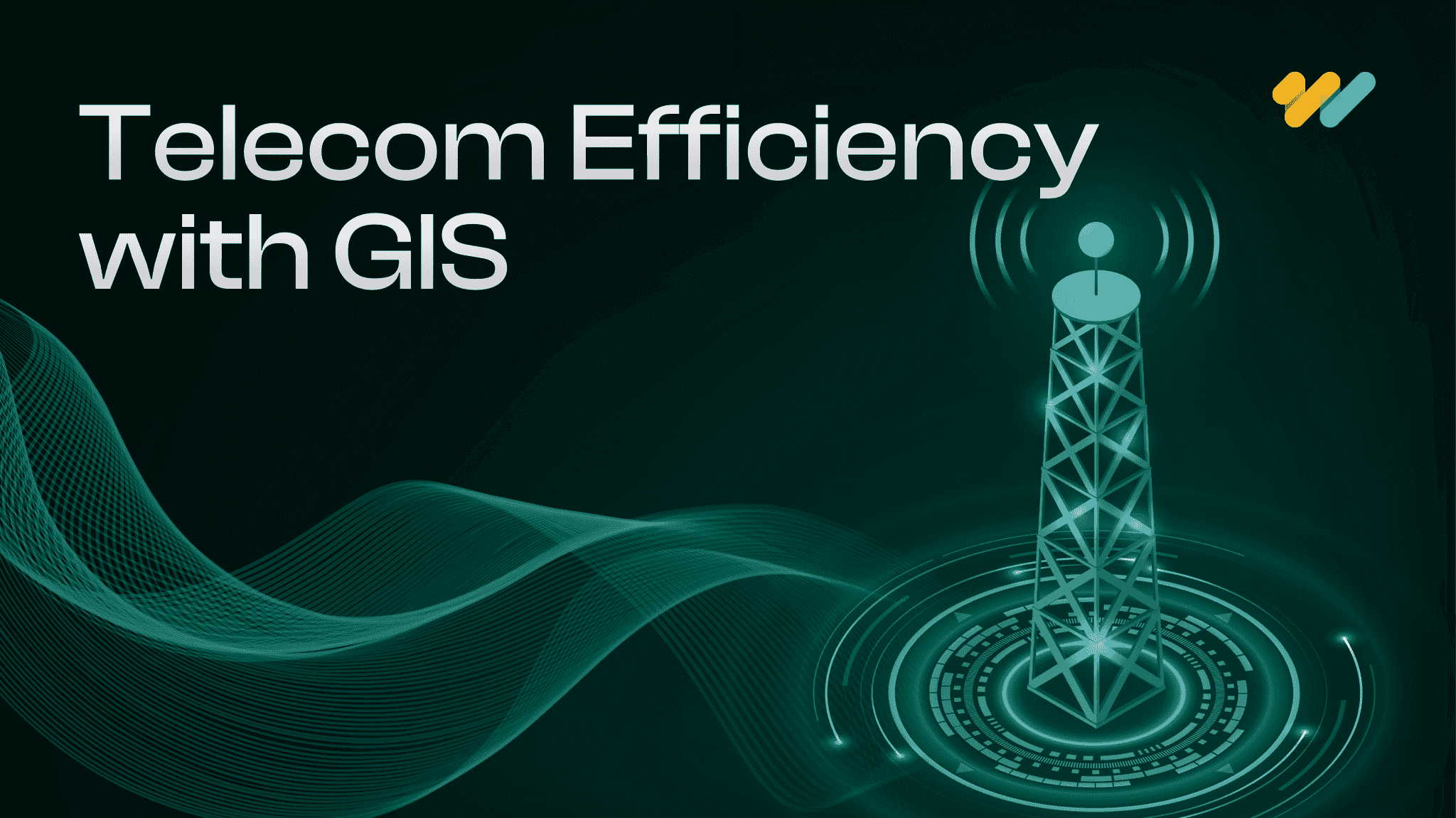
Infrastructure Monitoring
Transportation agencies increasingly combine satellite imagery, drones and AI to monitor bridges, railways and roads, enabling predictive maintenance and reducing the risk of unexpected asset failures.
Environmental Monitoring
Organizations such as Global Forest Watch use satellite imagery and AI to detect deforestation and monitor land-use change, providing near real-time environmental intelligence for governments and conservation agencies.
Geospatial Reasoning: What Makes AI Agents Different?
Large Language Models (LLMs) excel at understanding and generating text, but they do not inherently understand geographic space. An LLM may interpret a request correctly, yet it cannot determine whether locations are connected, whether terrain is suitable for development, or whether a proposed route is physically feasible. This is where geographic reasoning becomes essential.
By combining LLMs with spatial reasoning engines, AI agents evaluate geographic context before making decisions. They apply spatial rules and relationships to produce accurate, real-world outcomes rather than relying solely on language.
Rather than relying solely on language, geographic reasoning incorporates concepts such as topology, proximity, connectivity, terrain, temporal reasoning, spatial relationships and uncertainty to produce geographically accurate, context-aware and operationally reliable outcomes.
Why Agentic GeoAI Matters for Enterprises
As organizations collect larger volumes of spatial data from satellites, drones, IoT sensors and enterprise systems, traditional GIS workflows are becoming harder to scale. Agentic GeoAI addresses this challenge by enabling AI agents to coordinate data retrieval, spatial analysis, visualization and reporting with minimal human intervention. Recent research on autonomous GIS demonstrates that AI agents can independently perform tasks such as geospatial data retrieval, spatial analysis and map generation, pointing toward a new generation of intelligent GIS workflows.
For enterprises, the value extends beyond automation. AI agents can execute repetitive geoprocessing tasks, combine information from multiple spatial datasets and generate actionable outputs much faster than manual workflows. This allows GIS professionals to spend less time on routine processing and more time interpreting results and supporting business decisions. Esri also identifies workflow automation, predictive analytics and real-time operational monitoring as key benefits of GeoAI across enterprise environments.
Another important advantage is continuous situational awareness. Instead of relying on periodic manual analysis, AI agents can monitor satellite imagery, sensor feeds and enterprise spatial databases to detect meaningful changes and trigger follow-up analyses. Natural language interfaces further lower the barrier to GIS by allowing users to request complex spatial analyses without extensive scripting or GIS expertise.
Is Your GIS Platform Ready for AI Agents?
Adopting Agentic GeoAI involves more than integrating a large language model into an existing GIS environment. Organizations need a modern geospatial architecture that enables AI agents to access reliable data, interact with enterprise systems and operate within well-defined governance frameworks. Before implementing AI-driven GIS workflows, organizations should evaluate whether their platform is prepared for autonomous operations.
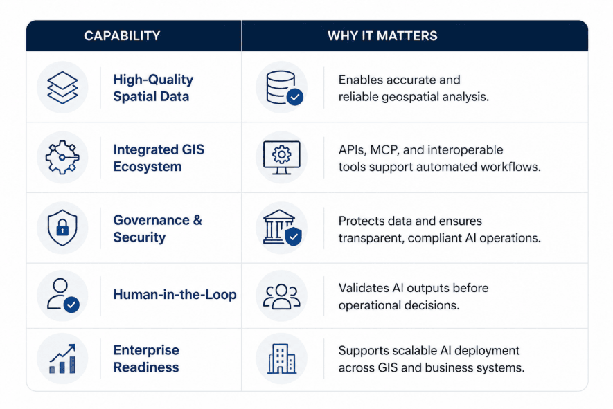
A practical readiness checklist includes:
Where Agentic GeoAI Is Heading?
The next evolution of enterprise GIS is shifting from AI-assisted tools to AI-driven workflows. Major GIS and cloud providers are already embedding generative AI, natural language interfaces and workflow automation into their platforms, indicating that autonomous GIS capabilities are moving from research to commercial adoption.
As these capabilities mature, AI agents will increasingly automate data discovery, spatial analysis, visualization and reporting while continuously monitoring satellite imagery, sensor networks and enterprise spatial databases to identify changes and trigger follow-up actions. At the same time, the growing adoption of digital twins and real-time geospatial platforms will enable organizations to simulate scenarios, monitor assets and support operational decision-making with continuously updated spatial intelligence.
Rather than replacing GIS professionals, Agentic GeoAI is expected to augment their expertise by automating repetitive workflows and enabling faster, more scalable decision-making. Organizations that adopt AI-native GIS platforms will be better positioned to manage growing spatial data volumes while maintaining governance, security and human oversight.
Conclusion
Agentic GeoAI marks a significant shift in how enterprise GIS operates. Rather than replacing GIS professionals, it transforms spatial workflows from manual, step-by-step processes into intelligent systems capable of planning, reasoning and executing geospatial tasks with human oversight. As organizations adopt AI agents the focus will move from operating GIS tools to supervising autonomous spatial analysis and making faster, data-driven decisions.
Success depends on integrating AI agents securely with existing GIS platforms, spatial data and business systems while maintaining governance, scalability and interoperability.
At 12th Wonder, we help organizations accelerate this transition by designing AI-powered geospatial solutions that integrate seamlessly with enterprise ecosystems. From workflow automation and platform modernization to AI integration and scalable application development, we enable businesses to build secure, intelligent GIS capabilities that deliver measurable operational value.
Transform GIS with AI Agents
Automate spatial analysis, accelerate decision-making and scale GIS with Agentic GeoAI.