
GeoAI Explained: How Geospatial AI is Solving Real-World Challenges in the U.S.
GeoAI: short for Geospatial Artificial Intelligence is the convergence of geospatial data (location, maps, remote sensing, GPS, GIS systems) with artificial intelligence/machine learning. It goes beyond mapping: GeoAI enables predictive, prescriptive, and real-time spatial insights. You feed in data about where things are, when they happen, and other attributes; you combine that with AI/ML, computer vision, spatio-temporal statistics, etc., to solve real-world problems.
In the U.S. today, GeoAI is increasingly vital because decisions are rarely just “what”, but “where” and “when.” Whether for climate risk, infrastructure planning, natural disaster response, insurance risk, public health, or urban design, location matters. GeoAI helps turn large volumes of spatial and temporal data into actionable insight.
Key Statistics & Market Momentum
- The Geospatial Analytics AI market (a core component of GeoAI) is projected to grow from US$0.11 billion in 2024 to US$0.42 billion by 2029, a CAGR of ~31%.
- The broader Geospatial Solutions market is likewise forecasted for strong growth as governments push smart city projects, infrastructure modernization, environmental monitoring etc.
- Organizations increasingly report that GeoAI is not just a research exercise but producing ROI in fields like utilities & energy, insurance, retail for things like predictive maintenance, risk assessment, site selection.
So the momentum is strong: demand, funding, regulatory pressure (e.g. climate, disaster, equity), and technological capability are aligning in the U.S.
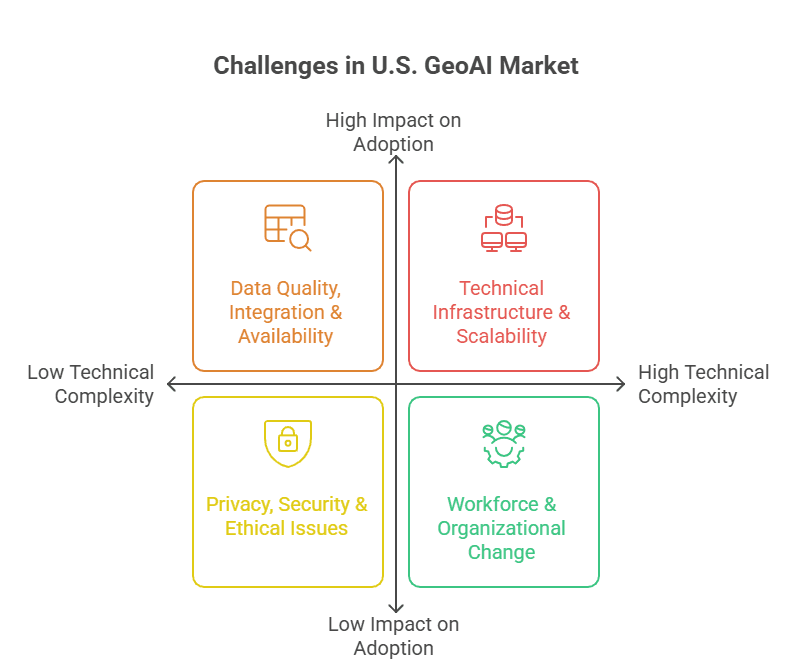
Challenges in the U.S. GeoAI Market
Despite the promise, there are notable challenges that companies face when implementing GeoAI in the U.S.:
1. Data Quality, Integration & Availability
- Geospatial data comes from many sources (satellite, drone, sensors, public and private GIS databases), which vary in resolution, format, update frequency, and licensing. Poor data quality leads to bad models.
- Temporal data (how things change over time) is often missing or inconsistent. Models trained only with “static snapshots” tend to perform poorly for forecasting.
2. Privacy, Security & Ethical Issues
- Geospatial data often encodes sensitive information people’s movements, property boundaries, infrastructure. There are regulatory, ethical, and reputational risks.
- Foundation models and large AI systems that ingest spatial data magnify risks if not properly governed.
3. Technical Infrastructure & Scalability
- High compute, storage, bandwidth requirements. Processing large volumes of satellite/drone imagery in near real time requires substantial investment.
- Integration with legacy GIS systems, operational systems, IoT sensors. Many organizations are not ready technologically or culturally.
4. Workforce & Organizational Change
- Skills gap: GIS experts, data scientists, ML engineers often work in silos. Bridging spatial expertise and AI/ML expertise is nontrivial.
- Resistance to change; unclear ROI; lack of clear business cases sometimes slows adoption.
5. Interpretability, Transparency & Trust
- Black-box models make decisions that affect people and communities (e.g. zoning, risk assessment, insurance). Stakeholders want to understand “why.”
- Ethical concerns about bias: where spatial data may reflect historical inequities (e.g. redlining, unequal infrastructure)
Solutions to Overcome the Challenges
Here are some ways organizations can address these challenges to get the full benefit of GeoAI:
| Challenge | Solution / Best Practices |
|---|---|
| Data Quality / Integration | Establish strong data governance; use standard formats; invest in high-quality, frequently updated spatial & temporal datasets; use synthetic / augmented data carefully. Increase access to high-resolution, real-time satellite/drone imagery; APIs/data marketplaces help. |
| Privacy & Ethics | Build privacy-preserving models (differential privacy, federated learning, secure multiparty computation); ensure compliance with U.S. regulations (e.g. CCPA, HIPAA where applicable); transparent model documentation; stakeholder engagement. |
| Infrastructure & Scalability | Use cloud computing, serverless architectures, edge computing for IoT; leverage streaming sensor data; pre-process imagery; use specialised hardware or optimised pipelines (GPUs, etc.). |
| Workforce & Change Management | Cross-training GIS & ML teams; embedding GeoAI roles; clear business cases and ROI metrics; pilot projects that show success; executive sponsorship. |
| Interpretability & Trust | Use interpretable ML models; build human-in-the-loop systems; provide visualisations; audit models for bias; regular validation and feedback from domain experts. |
Quantitative Benefits of GeoAI
GeoAI delivers measurable ROI for U.S. enterprises across industries:
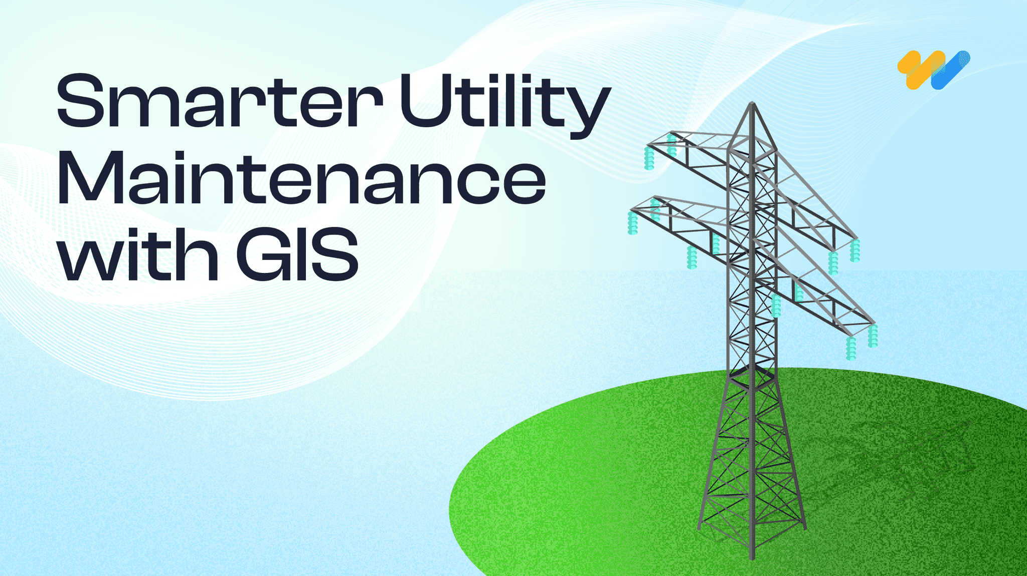
1. Utilities:
- 40% faster outage detection and resolution.
- 25% reduction in field maintenance costs.
2. Insurance:
- 30% more accurate risk assessments, lowering claim payouts by 15-20%.
3. Transportation & Logistics:
- Route optimization saves 15-25% on fuel costs annually.
4. Smart Cities:
- GeoAI-powered planning improves traffic flow by 20-30%, reducing emissions.
5. Disaster Response:
- Emergency teams can cut response times by up to 50% with real-time GeoAI insights.
(Sources: Esri, Fulcrum, LightBox)
These tangible benefits demonstrate why organizations investing in GeoAI see returns within 6–12 months.
Why 12th Wonder is the Ideal GeoAI Partner
At 12th Wonder, we help organizations in the U.S. unlock the full potential of GeoAI with:
Strategic Roadmapping: Identify high-value use cases and build a clear adoption plan.
Data Expertise: Sourcing, cleaning, and integrating spatial and temporal datasets ethically and securely.
Scalable Tech Infrastructure: Optimized pipelines for satellite, IoT, and real-time data at scale.
Cross-Functional Teams: GIS experts, data scientists, and domain specialists working together.
Trust & Transparency: Explainable AI dashboards and bias audits for reliable decision-making.
Regulatory Alignment: Deep knowledge of U.S. privacy laws and compliance needs.
With a proven track record, 12th Wonder bridges the gap between geospatial intelligence and AI innovation, delivering solutions that are scalable, ethical, and impactful.
Conclusion
GeoAI is more than a buzzword. It’s a powerful combination of spatial + temporal thinking, AI/ML, and domain expertise. In the U.S., sectors from utilities, insurance, infrastructure, public safety, climate resilience, and urban planning are already harnessing GeoAI for measurable impact. But challenges exist: data quality, privacy, infrastructure, trust, and human capacity.
If you want a partner who understands both the geospatial side and the AI side who can help you build scalable, ethical, performant, explainable GeoAI systems that’s where 12th Wonder comes in. With the right strategy, tools, people, and governance, GeoAI can unlock competitive advantage, resilience, and social good.
Start Your GeoAI Transformation Today
with expert guidance, ethical AI, and scalable solutions tailored to your industry.