

Geospatial Intelligence
Built for Real-World Impact
Unlock spatial insights, automate analysis with GeoAI, and accelerate decision-making.
Smarter Decisions. Faster Operations. Real ROI.
GeoAI-powered GIS solutions engineered for measurable business outcomes.
Slash operational inefficiencies with automated mapping & real-time updates
Get clean, unified geospatial data you can trust across the enterprise
Boost field productivity instantly with mobile-ready GIS workflows
Predict issues before they occur using AI-powered spatial analytics
Modernize legacy systems with scalable, cloud-ready architectures
Comprehensive GIS Solutions
GeoAI-powered GIS solutions engineered for measurable business outcomes.

Application Development & Upgrades
Expertise across Desktop, WebGIS, Mobile, and Open-Source platforms.
Experienced in developing, upgrading the enterprise applications across Desktop, WebGIS, Mobile, and Open-Source platforms

Image
Services
LiDAR processing, drone mapping, satellite imagery, data cleaning, geocoding.
Comprehensive services in Remote Sensing, LiDAR data processing, Digital Photogrammetry, and Digital Twin development.

GeoAI & Predictive
Analytics
Automated feature extraction, image classification, change detection, predictive modeling, route optimization.
Proficient in applying descriptive, diagnostic, predictive, and prescriptive analytics to unlock spatial deep insights.

Spatial Data
Services
GIS strategy, architecture, data modernization, governance, integrations, and managed support.
End-to-end support for data collection, network data capture, digitization workflows, quality improvements, and data maintenance

Data Migration
& Integration
Legacy migration, format conversion, cloud transitions, enterprise system integrations.
Skilled in migrating data between diverse platforms while ensuring seamless work-order processing, effective change management, and reliable post-processing integrations.

Managed
Services
Network capturing, digitization, maintenance, positional accuracy improvements.
Integrated services for network planning, design and drafting, OSP support, and reliable data conflation
Challenges We Solve
Turning geospatial obstacles into competitive advantages
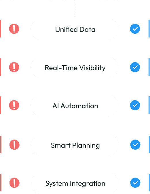
Unified Data
Challenge
Your geospatial data is fragmented and outdated.
Solution
Our comprehensive geoprocessing toolkits detect issues and help you correct them
Real-Time Visibility
Challenge
Field teams lack visibility into asset conditions and locations.
Solution
Efficiently synchronize real-time data using configurable device applications
AI Automation
Challenge
Imagery processing is slow and manual.
Solution
AI-driven feature extraction speeds up analysis by up to 80%.
Smart Planning
Challenge
Planning and resource allocation are inefficient.
Solution
Predictive models and spatial analytics optimize routes and workforce.
System Integration
Challenge
Enterprise systems are not integrated with GIS.
Solution
Secure ERP, CRM, IoT, and cloud integrations ensure seamless visibility.
Why 12thWonder
Why Leading Enterprises Choose Us.

Horizontal Knowledge
Where geospatial disciplines converge seamlessly

Broad Geospatial Domains
GIS embedded across industries and use cases

Enterprise Strength Engineering
Center of Excellence for Enterprise Geospatial Solutions

Large Scale Codebase
Built on a deep geospatial code foundation

Outcome-First Methodology
Everything optimized for cost, accuracy, and operational uplift
When accuracy, scalability, and speed matter, we're the partner enterprises trust.
Industries We Serve
Delivering specialized GIS solutions across critical sectors.

Utilities & Energy
Asset tracking, vegetation analysis, outage optimization.

Telecom
Tower planning, network design, coverage analytics.

Infrastructure & Construction
Progress monitoring, site analytics, digital twins

Mining & Natural Resources
Operational planning, asset visibility, terrain intelligence.

Government & Smart Cities
Urban planning, infrastructure intelligence, city analytics.

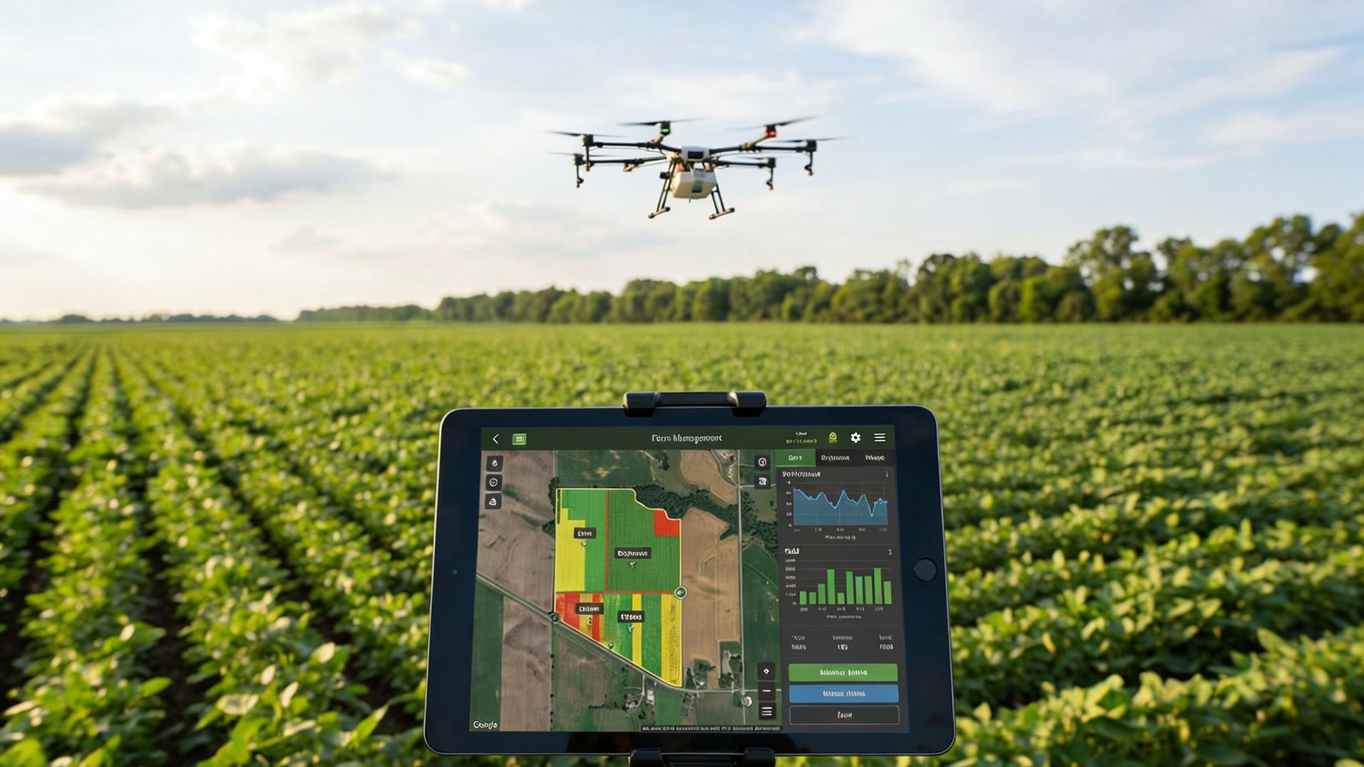
Agriculture
Progress monitoring, site analytics, digital twins
Measurable ROI. Proven Results.
Our clients achieve transformative outcomes through data-driven geospatial solutions.
30-60%
reduction in field inspection costs
80%
faster image processing
25-40%
uplift in asset lifecycle planning
50%
reduction in manual data preparation
20-35%
improvement in fleet efficiency
Resource Center
Insights, case studies, and guides to help you maximize your geospatial investments.

Will Data Centres Become the Biggest Bottleneck in AI?
AI demand is driving one of the largest expansions of computing infrastructure in recent history. According to a Reuters report published in July 2026, Hut 8 signed a $9.8 billion lease
Environmental Monitoring and Risk Assessment Using GIS Spatial Services
A government environmental protection agency in North America is responsible for monitoring forests, wildlife habitats, water resources and environmental risks across a large
Start with pgvector: When Enterprise RAG Needs a Dedicated Vector Database
A RAG system can have a powerful LLM and still fail because the retrieval layer brings the wrong context.
Ready to Transform Your Geospatial Ecosystem?
Partner with 12thWonder to unlock the full potential of your spatial data. Let's build solutions that drive real impact.


