Digital Twins & 3D GIS Modeling: Global Benefits, Challenges & Solutions
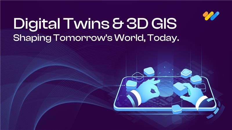
Digital twins and 3D GIS modeling are redefining how organizations plan, operate, and maintain physical assets and environments. By combining precise three-dimensional spatial models with real-time data, IoT sensors, and advanced analytics, these technologies create a virtual replica of the real world, enabling simulation, prediction, and optimization before taking physical action.
From smart cities and utilities to manufacturing, logistics, transportation, and climate resilience, digital twins and 3D GIS modeling are unlocking new possibilities for innovation, efficiency, and risk reduction worldwide.
Why Digital Twins & 3D GIS Modeling Matter
3D GIS modeling provides a detailed, visual understanding of assets and environments, including height, volume, and topology. Digital twins enhance this by integrating live operational data to track performance, simulate future scenarios, and drive decisions in real time.
Key applications across industries include:
- Smart Cities & Urban Planning: Visualize traffic patterns, zoning plans, and environmental impacts to design sustainable cities.
- Infrastructure & Construction: Monitor bridges, pipelines, or buildings for predictive maintenance and lifecycle management.
- Utilities & Energy: Optimize grid performance, plan renewable energy deployment, and reduce outages.
- Manufacturing & Logistics: Improve factory operations, inventory forecasting, and supply chain visibility.
- Emergency Response & Climate Resilience: Simulate storm surge, floods, or wildfire spread for better preparation and faster response.
In short, these technologies bring together geospatial intelligence and operational insight, helping decision-makers see problems before they happen.
Market Momentum & Growth
The demand for digital twins and 3D GIS modeling is accelerating globally :
- The global digital twin market is projected to reach $73.5 billion by 2027, growing at a CAGR of over 40%.
- As per 12th Wonder research, 3D GIS solutions are expected to surpass $11 billion by 2030, driven by smart city initiatives, infrastructure investments, and sustainability programs worldwide.
- As per AnyLogic, Companies adopting digital twins report 20–30% reductions in operational costs and up to 57% improvement in forecasting accuracy.
Governments and private enterprises alike are accelerating adoption, especially in sectors like utilities, public safety, mobility, and urban development.
Key Challenges to Adoption
While the benefits are clear, organizations face common challenges when deploying digital twins and 3D GIS models:
- High Initial Investment – Building accurate 3D models, integrating IoT devices, and acquiring cloud infrastructure can require significant upfront spend.
- Data Quality & Interoperability – Combining legacy systems, 3D models, and live sensor data often leads to inconsistent formats and integration issues.
- Scalability & Real-Time Performance – Streaming data at scale demands advanced computing power and efficient pipelines.
- Workforce & Skills Gap – GIS experts, engineers, and data scientists often work in silos, making collaboration difficult.
- Security & Privacy Risks – Sensitive infrastructure and operational data must be protected to avoid breaches and compliance issues.
- Maintaining Accuracy Over Time – Models degrade if not continuously updated with current data and environmental changes.
Solutions to Overcome These Challenges
| Challenge | Solution |
|---|---|
| High Costs | Start with pilots; use scalable cloud platforms; leverage open data and open standards to reduce licensing costs. |
| Data Quality & Integration | Establish strong data governance; adopt standards like CityGML and IFC for BIM; use middleware for interoperability. |
| Scalability | Employ cloud-native and edge computing; optimize models for level of detail; leverage GPU acceleration. |
| Workforce Gaps | Cross-train teams, hire multi-disciplinary experts, and engage strategic partners. |
| Security & Compliance | Use encryption, anonymization, and access controls; follow local and international privacy laws. |
| Ongoing Model Accuracy | Automate data pipelines for updates; monitor deviations; schedule audits to maintain model reliability. |
Quantitative Benefits: Measurable Impact
Digital twins and 3D GIS modeling provide clear, quantifiable benefits across industries:
1. Infrastructure & Utilities
- 20–30% reduction in maintenance costs through predictive maintenance.
- 40% faster outage detection and response time.
2. Supply Chain & Logistics
- 57% improvement in delivery forecasting accuracy.
- 20% lower logistics and inventory costs.
3. Urban Planning & Smart Cities
- 20–30% reduction in traffic congestion using simulation-based planning.
- 0–15% improvement in energy efficiency for city districts and campuses.
4. Disaster Preparedness
- 30–40% reduction in potential damage costs through better simulations and planning.
- Emergency response times cut by up to 50% with real-time 3D monitoring.
These gains often materialize within 6–18 months, making the business case for adoption compelling.
Why 12th Wonder is the Right Partner
Implementing digital twins and 3D GIS modeling requires the right strategy and execution. 12th Wonder helps organizations across markets achieve success by providing:
- Strategic Roadmapping: Identifying high-value use cases to ensure ROI.
- Data & Modeling Expertise: Building accurate, scalable 3D models and integrating real-time IoT data.
- Cloud & Edge Infrastructure: Designing systems for performance and scalability.
- Cross-Functional Teams: Bringing together GIS professionals, engineers, and data scientists.
- Security & Compliance Knowledge: Aligning with global standards and data privacy regulations.
- Lifecycle Management: Ensuring models stay accurate and up-to-date for long-term value.
With 12th Wonder, organizations can confidently deploy digital twin ecosystems that are innovative, secure, and results-driven.
Conclusion
Digital twins and 3D GIS modeling are practical tools that deliver measurable results today. By visualizing environments, integrating live data, and simulating scenarios, they help businesses reduce costs, mitigate risks, and plan smarter.
For organizations ready to embrace this transformation, the right partner can make all the difference. 12th Wonder combines technical expertise, strategic vision, and proven processes to help you turn complex spatial challenges into actionable intelligence, no matter your industry or region.
Start Your Digital Twin & 3D GIS Transformation Today
Expert guidance for smart cities, utilities, and infrastructure projects.


