
Geospatial Revolution: Top 10 Industries Benefiting from GIS
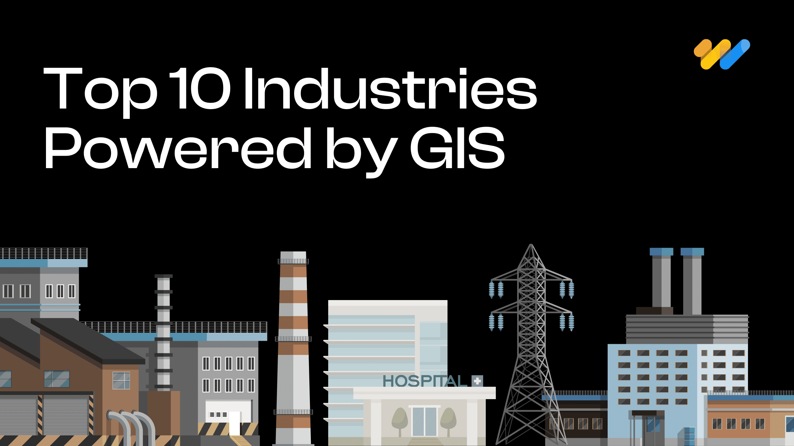
Geographic Information Systems (GIS) have emerged as a powerful tool for businesses and organizations across various sectors. GIS technology integrates, stores, analyzes, and visualizes spatial information and related attributes, providing valuable insights that drive informed decision-making. As we delve into the top 10 industries benefiting from GIS integration, we’ll explore how geospatial technology is revolutionizing operations, improving efficiency, and creating new opportunities for growth and innovation. In addition, we will also explore how 12W offers our GIS solution and product landscape across multiple industry segments. Let’s dive in.
1. Agriculture
GIS allows users to map and analyze large volumes of complex data. In agriculture, GIS enables farmers to map field data, organize and analyze it, and monitor crops or livestock remotely. Geospatial technology combined with GPS, robotics, drones, and satellite monitoring has revolutionized farming practices increasing crop yields, resource efficiency, and mitigating risks. Some of the major applications of GIS in agriculture include,
- Precision Farming: GIS allows farmers to monitor crop health, soil conditions, and weather patterns, leading to more precise farming techniques that optimize irrigation, fertilizer, and pesticide application, leading to cost savings and minimizing environmental effects.
- Crop Monitoring and Management: By using satellite imagery and drones, farmers can detect issues such as pest infestations or nutrient deficiencies early, allowing for timely interventions.
- Soil Analysis and Land Suitability: GIS helps farmers analyze soil types and determine the best crops for specific areas, optimizing land use, and improving productivity.
For instance, John Deere’s precision farming technology uses GIS to provide farmers with detailed maps of their fields. This allows them to apply fertilizers and pesticides more efficiently, reducing costs and environmental impact.
At 12W, we utilize real-time monitoring of crop growth combined with weather data through high-resolution imagery to assist decision-makers in allocating budgets for agriculture and ensuring the anticipated crop yield
2. Urban Planning
GIS transforms urban planning by allowing planners to analyze various data sources, including satellite imagery, aerial photography, and demographic information, and integrate them to create comprehensive mapping systems. While GIS-based applications are used for multiple purposes from increasing public engagement in city planning to managing infrastructure development, some of the major applications of GIS in urban planning are,
- Infrastructure Development: GIS aids in planning and managing urban infrastructure projects by providing detailed spatial data on land use, population density, and transportation networks.
- Zoning and Land Use Planning: Planners use GIS to create zoning maps and land use plans that promote sustainable development and efficient land utilization.
- Smart Cities and Sustainable Development: GIS supports the development of smart cities by integrating various data sources to manage resources efficiently and improve the quality of life for residents.
A major example of GIS in urban planning is how the city of Singapore uses GIS for its Urban Redevelopment Authority (URA) to plan and manage land use. GIS helps the city to create sustainable urban environments and optimize space utilization in densely populated areas.
At 12W, we help clients with digital twin technology and ArcGIS City Engine in the urban sector to gain insights into construction and 3D modelling of terrain and assets.
3. Transportation and Logistics
Transportation and logistics industry uses GIS systems extensively for real time tracking, traffic flow analysis and enhanced supply chain visibility enabling companies to reduce fuel consumption, improve delivery times, and enhance overall operational efficiency. Key applications of GIS in transportation and logistics include:
- Route Optimization: GIS helps in optimizing delivery routes, and reducing travel time, fuel consumption, and operational costs.
- Fleet Management: Companies use GIS to track and manage their fleets in real time, improving efficiency and reducing downtime.
- Traffic Analysis and Management: GIS provides insights into traffic patterns, helping in the planning and management of transportation systems to reduce congestion and improve safety.
UPS uses GIS to optimize delivery routes through its ORION system, which saves millions of miles driven each year, reducing fuel consumption and improving delivery times.
We help urban planners effectively utilize Points of Interest (POI) from open-source data to develop open-source applications featuring geocoded photographs and optimized routing in the transportation sector.
4. Environmental Management
Environmental scientists and policymakers can assess scenarios, model outcomes, and plan interventions more effectively when they have a spatial understanding of environmental issues. GIS plays a vital role in developing more effective conservation strategies and sustainable resource management practices by providing a comprehensive view of ecosystems and their interactions. Some of the key applications of GIS in environment management include,
- Resource Conservation: GIS aids in the sustainable management of natural resources by providing detailed data on forests, water bodies, and minerals.
- Environmental Monitoring: GIS is used to monitor environmental changes, such as deforestation, pollution, and climate change, enabling timely interventions.
- Impact Assessment: GIS helps in conducting environmental impact assessments for proposed projects, ensuring compliance with regulations and minimizing negative effects.
The World Wildlife Fund (WWF) uses GIS to monitor deforestation in the Amazon rainforest. This helps in tracking illegal logging activities and planning conservation efforts.
We use high-resolution imagery to detect changes in land patterns and monitor rainfall, ensuring that all environmental parameters align with imagery analysis and ground reports to create advanced environment monitor, management and prediction systems.
5. Utilities and Energy
Utility and energy providers face challenges managing field workforces, digitizing data, addressing weather-related outages, and more. The energy and utilities sector relies heavily on GIS for infrastructure management, resource exploration, and service delivery optimization. Geospatial data and GIS systems are vital to the sector, be it power grid management and outage response, oil and gas exploration, or smart meter deployment and management. Some of the major use cases for GIS in utilities and energy include,
- Asset Management: GIS enables utility companies to maintain detailed records of their assets, such as pipelines, power lines, and water networks, more efficiently, improving maintenance and reducing downtime.
- Network Planning and Maintenance: GIS helps in planning the maintenance and expansion of utility networks, ensuring reliable service delivery and reducing downtime.
- Renewable Energy Site Selection: GIS is used to identify suitable sites for renewable energy projects, such as wind farms and solar power plants, based on factors like sunlight, wind patterns, and land availability.
Pacific Gas and Electric Company (PG&E) uses GIS to manage its electric and gas infrastructure. This includes monitoring the condition of assets and planning maintenance activities to prevent outages.
At 12W, we develop in-house utility products built on ESRI, Hexagon, and open-source platforms, streamlining the digitalization process and ensuring high-quality deliverables for the industry. These configurable products empower decision-makers to accelerate project execution and Proof of Concept
6. Healthcare
In Healthcare, geospatial technology plays a crucial role in improving patient care and public health outcomes. GIS systems help integrate health data with spatial data to identify patterns, risk factors, and outbreaks for informed decision-making and timely interventions. GIS supports public health initiatives by identifying needs, targeting interventions, and tracking outcomes. GIS technology is extensively used in Healthcare for
- Disease Mapping and Epidemiology: GIS is crucial in tracking the spread of diseases, identifying hotspots, and planning interventions to control outbreaks.
- Healthcare Facility Planning: GIS helps in planning the location of healthcare facilities to ensure optimal access for the population.
- Emergency Response and Management: GIS supports emergency response efforts by providing real-time data on affected areas, helping in resource allocation and coordination.
During the COVID-19 pandemic, Johns Hopkins University used GIS to create an interactive dashboard that tracked the spread of the virus globally, helping public health officials and the public stay informed.
We implement IoT-enabled real-time applications to monitor the health of assets such as medicines and ambulances, ensuring patient safety and facilitating the quickest routes to their destinations.
7. Real Estate
Geospatial technology is transforming the real estate industry by providing valuable insights into property values, market trends, and development opportunities by integrating a wide variety of data sources. The applications of GIS in real estate range from property valuation to portfolio management and virtual property tours. The key applications of GIS include,
- Market Analysis: GIS provides invaluable insights into location, amenities, and market conditions for property valuation and market analysis, aiding buyers, sellers, and investors.
- Site Selection: Real estate developers use GIS to identify suitable sites for development based on factors like demographics, infrastructure, and environmental conditions such as potential risks such as natural hazards.
- Customer Insights: GIS helps in analyzing customer demographics and behavior, enabling targeted marketing and better customer service.
Zillow uses GIS to provide detailed maps and property information to homebuyers and sellers, helping them make informed decisions about real estate investments.
We ensure the safety of residents through our digital twin program, which also helps reduce costs during the construction phase. Additionally, we implement geotagging of building footprints and develop enterprise GIS applications to facilitate seamless property tax payments, avoid water logging areas, weather alerts from Government.
8. Telecommunications
In Telecommunications, GIS helps to integrate spatial data with complex network data and external sources providing a comprehensive view of the infrastructure. Some of the major applications of GIS in Telecommunications include,
- Network Coverage Analysis: GIS is used to analyze network coverage and identify areas with poor or no coverage, helping in network expansion and optimization.
- Infrastructure Planning: Telecommunications companies use GIS to plan the placement of towers, cables, and other infrastructure to ensure optimal coverage and service quality.
- Customer Service Optimization: GIS helps in analyzing customer data and service usage patterns, enabling better customer service and support.
Verizon uses GIS to plan the expansion of its 5G network, ensuring optimal coverage and service quality by analyzing population density and existing infrastructure.
We integrate data from various sources such as CRM and ERP, applying business rules to minimize outages with our applications. Additionally, we implement G-Technology to create streamlined, scalable solutions that reduce startup costs and infrastructure needs. It serves as a definitive source of reliable, location-based information that can be shared with users and systems throughout the organization.
9. Retail
Retail is a highly competitive market and GIS technology enables retailers to gain a competitive edge and enhance profit margins by providing insights into customer behavior, competition, and market trends.
- Market Analysis and Site Selection: Retailers use GIS to analyze market trends and demographics, helping in selecting the best locations for new stores.
- Supply Chain Management: GIS aids in optimizing supply chain operations by providing real-time data on inventory, transportation, and distribution.
- Customer Behavior Analysis: GIS helps retailers understand customer behavior and preferences, enabling personalized marketing and improved customer experiences.
For instance, Starbucks uses GIS to analyze customer demographics and behavior, helping them choose new store locations that maximize foot traffic and sales.
10. Public Safety and Disaster Management
GIS is crucial for emergency response and disaster management by providing real-time situational awareness and decision support. With GIS, emergency responders can act more quickly and effectively, potentially saving lives and minimizing property damage during crises.
GIS is used in Public Safety to provide a deeper understanding of threats and hazards, enabling targeted prevention and mitigation efforts. GIS leverages real-time data to inform mission-critical decisions, improving response times and effectiveness.
- Crime Mapping and Analysis: GIS is used by law enforcement agencies to map and analyze crime patterns, helping in resource allocation and crime prevention strategies.
- Emergency Response Planning: GIS supports emergency response planning by providing data on vulnerable areas, and associated risks helping in the efficient deployment of resources in emergencies.
- Community Policing: GIS helps in community policing efforts by providing insights into community needs and enabling better resource allocation.
The New York Police Department (NYPD) uses GIS for crime mapping and analysis, which helps in deploying officers more effectively and reducing crime rates in high-risk areas.
Conclusion
GIS integration is transforming industries across the board, providing valuable insights, improving efficiency, and driving innovation. From urban planning to agriculture, healthcare to emergency services, the power of location intelligence is revolutionizing how organizations operate and make decisions.
The future of GIS integration looks even more promising, with advancements in artificial intelligence, the Internet of Things (IoT), and big data analytics set to further enhance its capabilities. As businesses and organizations continue to recognize the value of spatial data, we can expect to see even more innovative applications of GIS technology across various sectors.
If your organization hasn’t yet explored the potential of GIS integration, now is the time to consider how this powerful technology can transform your operations and drive growth. At 12W, we integrate AI and ML with GIS to streamline processes, automate features with minimal effort, and ensure high-quality output for each industry. By partnering with experienced GIS solution providers like 12th Wonder, you can unlock the full potential of location intelligence and gain a competitive edge in today’s data-driven world.
Recent Blogs

Will Data Centres Become the Biggest Bottleneck in AI?
AI demand is driving one of the largest expansions of computing infrastructure in recent history. According to a Reuters report published in July 2026, Hut 8 signed a $9.8 billion lease
Read more...
Start with pgvector: When Enterprise RAG Needs a Dedicated Vector Database
A RAG system can have a powerful LLM and still fail because the retrieval layer brings the wrong context.
Read more...
RAG vs Fine-Tuning: Which Approach Fits Your Enterprise Use Case?
In 2025, enterprise AI moved beyond experimentation and into real business workflows. McKinsey reported that 71% of organizations
Read more...
Beyond Model Accuracy: LLM Evaluation and Observability for Business AI
Organizations are moving beyond asking "Can we build it?" and increasingly asking "Can we trust it in production?
Read more...
Spatial RAG: The Missing Layer Between GIS Data and LLMs
Ask an LLM which substations are inside a flood zone, and it may answer confidently without performing a spatial query.
Read more...
Agentic Testing: The Complete 2026 Guide to Autonomous Software Testing
Traditional test automation helped teams scale quality, but modern applications are evolving faster than many automation frameworks
Read more...
What Is MCP? Understanding the Model Context Protocol for Enterprise AI
AI agents are rapidly becoming part of the enterprise technology stack. Organizations are deploying engineering copilots, customer
Read more...
Agentic GeoAI: AI Agents Transforming Enterprise GIS Workflows (2026)
A flood warning is issued. By the time analysts collect satellite imagery, run spatial models, validate results and distribute reports,
Read more...
Frontier AI Models Guide: OpenAI vs Claude vs Gemini (2026)
Every major AI provider is promising to be your enterprise AI platform. Many organizations initially evaluat
Read more...
Build vs Buy: AI Agent Platforms Compared (2026)
Enterprise AI has evolved beyond simple chatbots into operational ecosystems capable of workflow automation, system integration, and real-time decision-making
Read more...
Claude Fable 5: The Mythos-Class AI Model You Can Use in 2026
Anthropic's Claude Fable 5 is the first publicly available Mythos-class AI model, representing a significant step beyond traditional AI assistants.
Read more...
Multi-Agent Systems for Business: A Practical Enterprise Guide (2026)
Enterprise AI is quietly moving away from the idea of one system doing everything. The future of enterprise AI is increasingly being shaped by coordinated intelligence
Read more...
AI Agent Security: Defending Against Prompt Injection in Enterprise AI Systems
The rate of adoption of autonomous AI agents by businesses is growing quickly. Autonomous AI agents have become commonplace, where they are being used to automate workflows, engage with customers,
Read more...
AI Agent ROI: How to Measure It Before You Build
What was once considered cutting-edge technology reserved for large tech firms has now become part of everyday business operations
Read more...
RAG Explained: The Complete Guide to Retrieval-Augmented Generation for Enterprise AI (2026)
Somewhere in your organization right now, an AI assistant just answered a question with complete confidence and complete inaccuracy. It cited a policy from two years ago, a product that was discontinued last quarter,
Read more...
EU AI Act Compliance Checklist: Everything Enterprises Need to Know Before 2027
AI governance has moved from a boardroom discussion to a legal obligation. The EU AI Act is the most comprehensive artificial intelligence policy framework enacted anywhere in the world and enforcement is already underway.
Read more...
Small Language Models vs LLMs: A Practical Guide to Choosing the Right AI Model for Your Business
The conversation around enterprise AI in 2026 has shifted. While large language models like GPT-4 and Claude still dominate headlines, a quieter revolution is happening at the edge.
Read more...
How to Build an AI Agent for Your Business: A Practical Guide (2026)
AI agents are no longer a future-facing experiment. Businesses across industries are using them to handle real workflows right now, and the
Read more...
AI and the Energy Crisis: How Data Centers Are Reshaping the Global Power Grid in 2026
AI data center energy consumption has become one of the defining infrastructure challenges of this decade. The numbers are no longer abstract.
Read more...
AI in the Supply Chain: Where Value Is Actually Created
AI adoption across supply chains is accelerating. Investment is growing, pilots are expanding, and technical capability is improving quickly.
Read more...
Vibe Coding in 2026: The Complete Guide to AI-Powered Development
Vibe coding is a natural-language-first approach to software development where you describe what you want in plain English and AI generates functional code for you.
Read more...
AI Trends in 2026: 7 Predictions That Will Reshape Every Industry
The most important AI predictions for 2026, agents, generative AI, industry transformation, governance and what's next. A practical guide for business and technology leaders.
Read more...
Real-Time Visibility in Logistics: Why Your Architecture Is Costing You More Than You Think
Here is a number worth pausing on: 45% of logistics organizations have real-time visibility into fewer than half their shipments.
Read more...
Why Field Operations Break When You Can’t See Them on a Map
Field operations rarely fail because teams are not working hard enough. They fail when leaders lose visibility into what is happening, where it is happening, and why.
Read more...
What Your GIS Data Actually Needs for GeoAI
We examined why many GeoAI projects fail before they even get started in the previous blog. Let's now discuss what makes GeoAI function in the real world.
Read more...
Why GeoAI Projects Fail Before They Even Start
GeoAI is currently omnipresent. In order to anticipate failures, automate decision-making, and make sense of intricate networks, utilities,
Read more...
GIS Drone Mapping: How Drones Are Powering the Next Era of Real-Time Geospatial Intelligence
GIS drone mapping is rapidly transforming how organizations collect, analyze, and act on geospatial data.
Read more...
Digital Twins & 3D GIS Modeling: Global Benefits, Challenges & Solutions
Digital twins and 3D GIS modeling are redefining how organizations plan, operate, and maintain physical asset
Read more...
GeoAI Explained: How Geospatial AI is Solving Real-World Challenges in the U.S.
GeoAI: short for Geospatial Artificial Intelligence is the convergence of geospatial data (location, maps, remote sensing, GPS, GIS systems)
Read more...
The ROI of Implementing a GIS Solution: A Business Case Study Approach
Relying on fragmented data and outdated mapping tools is no longer sustainable for organizations navigating complex,
Read more...
The Telecom Data Migration Imperative: Challenges, Best Practices & Future-Ready Strategies
As telecom networks rapidly evolve from 4G to 5G and legacy OSS/BSS stacks shift
Read more...
Building a Future-Ready Telecom Data Migration Framework: Tools, Automation, and Real-World Lessons
Telecom data migration is not just about moving data it's about ensuring scalability, security,
Read more...
Top 7 Emerging AI Trends to Watch in 2025
Pushing deeper into 2025, artificial intelligence continues to sprint from being a promising tool to
Read more...
Empowering Smarter Cities: The Role of Geospatial Digital Twins in Urban Planning
Geographic Information Systems (GIS) have emerged as a powerful tool for businesses and organizations across various sectors.
Read more...
Enhancing Customer Experience with Location-Based Services Powered by GIS
Customer experience has emerged as a key differentiator for organizations across industries be it in utilities, retail or public services.
Read more...
Transforming Field Operations with Mobile GIS
Be it in utilities, transportation, or environmental management, field operations are complex and challenging.
Read more...
Emerging trends in GIS: Navigating the geospatial landscape
GIS or Geographical information systems has helped turn maps into advanced tools for problem-solving.
Read more...
How GIS is transforming predictive maintenance in the utility sector
The utility sector is the backbone of the modern economy providing vital services like electricity, water, and gas to people and businesses.
Read more...
Case study spotlight: Streamlining HFC network management with GIS for a US-based Telecom Service Provider
GIS (Geographical Information System) has been crucial to the growth of the telecom sector, providing invaluable geospatial data that benefits even
Read more...
GIS In Action: Real-World Examples of How It's Used
Geographic Information Systems (GIS) have become indispensable tools across a multitude of industries, revolutionizing the way we understand, analyze, and interact with spatial data.
Read more...
Case Study Spotlight: Revolutionizing Utility Asset Management
At 12th Wonder, we are transforming the way utility companies manage their assets. In one of our recent projects, we partnered with a leading utility
Read more...
The Cutting-Edge Benefits of GIS For Telecom Networks
Geographic Information Systems (GIS) are making a big impact in the telecommunications world. Think of GIS as a powerful tool that transforms heaps of data into clear, useful maps.
Read more...
What is Mobile GIS? Here’s what you should know.
The world of Geographic Information Systems (GIS) is changing quickly, and mobile GIS is leading the way. At 12thWonder, we’re using this exciting technology to transform how field data
Read more...
A mix of Introductory and Advanced Geospatial Solutions: 12W's Approach
Geospatial solutions are revolutionizing the way we understand and interact with the space around us. We are at the forefront of this transformative wave, a company that has seamlessly integrated technology
Read more...
The Importance of Data Interoperability in Today’s Geospatial Solutions
Have you ever wondered what makes the digital world tick seamlessly? It’s the magic of data interoperability, especially in the realm of geospatial solutions.
Read more...
Leading Top 10 Best Geospatial Companies
This guide highlights the top 15 GIS (Geographic Information Systems) companies leading the way with their cutting-edge solutions in mapping and spatial analysis.
Read more...
Getting Started in QA Test Automation: Essential Tips for Beginners
Starting on the journey of Quality Assurance (QA) test automation can be both exciting and challenging, especially for companies taking their first steps in this domain.
Read more...
How to Choose the Right QA Services Provider for Your Business: Including a Checklist
In today’s competitive market, software quality assurance (QA) is vital for ensuring robust, reliable, and high-performing software solutions.
Read more...
Solve Your Business Challenges with 12th Wonder's Tailored Digital Transformation Solutions!
Ready to elevate your business with cutting-edge digital solutions? At 12th Wonder we offer a suite of innovative software services. Our goal is to empower your workforce and lead your business towards
Read more...
Integrating QA Test Automation and Manual Testing: A Balanced Approach in Software Development
In software development, you can achieving the highest quality of product by using a strategic blend of both QA test automation and manual testing. While automation is offers speed and repeatability
Read more...
5 Ways QA Automation Can Transform Your Business
Staying ahead of the competition requires including innovative approaches to improve efficiency and quality. This is where QA automation comes into play.
Read more...
Dictionary of GIS Terms
Aerial Photography Mapping: The creation of maps based on the interpretation and analysis of aerial photographs, utilizing differences in vantage points and angles to construct detailed
Read more...
Leading Top 15 Best Software Testing & Quality Assurance Global Companies
This guide highlights the top 15 software testing companies that consistently deliver high value from small, mighty teams. It emphasizes the critical role of QA testing in ensuring software quality
Read more...
Maximizing Business Value: The Transformative Power of Automation in Quality Assurance Services
The integration of automation in Quality Assurance (QA) services has transformed industries by enhancing efficiency, accuracy, and cost-effectiveness.
Read more...
Navigating the Pitfalls of Application Development: How We Ensure a Smooth Journey
The process of application development can be both exciting and daunting. From the spark of an idea to the polished end product, there are numerous stages where errors might occur.
Read more...
Quality Assurance Redefined: Your Path to Success with 12thWonder
Are you ready for help with ensuring the highest quality for your products? Collaborating with 12thWonder for Quality Assurance (QA) services opens the door to a transformative experience that
Read more...
Streamline Your Testing Process with 12th Wonder's Test Automation Services
In this ever-evolving world of software development, where changes happen at the drop of a hat, ensuring quality, speed, and reliability is absolutely essential.
Read more...
7 Ways QA Services Can Reduce Costs in Software Development
In today’s fast-paced world of software development, your company faces a myriad of challenges. Balancing quality and cost-effectiveness is a perpetual struggle.
Read more...