Data Digitization
Data Digitization and Network Capturing
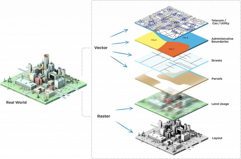
GIS conversion is the process of geographical data conversion from one format to another through geographic information systems. With the large amount of geographical data at our exposure, it is always wise to go for data conversion rather than recreating it.
Network improvements & Maintenance
Need to ensure networks that are impacted with incremental changes to the existing network. Our configurable rule base validates the data and its dependencies on the fly as per the network rule bases. Thus, it enables efficiency, optimizations, error-free networks, and integrity.
Network Capturing & Digitization
Data capturing and digitization of the network can be simplified with 12th Wonder's in-house applications using georeferenced images and maps and maintaining the land base with a dynamically configured rule base. Our in-house applications improve operations efficiency and enable informed decisions by combining expertise in various domains and experience in designing, building, and integrating network data across platforms.
Data Conflations & Positional Accuracy Improvements
With the continuous improvements in the land base accuracy, network data layered on top of the land bases must be aligned accordingly. Hence conflation data with land base is a continuous process. In most of the scenarios land base is supplied by either land base vendors or the government organizations periodically. Our in-house conflating tools adjust the network data based on the conflation points and provides us confidence value to review the false positives.
12W Work Process