
Case Study – Data Digitization for a U.S. Infrastructure Development Firm
About the Client
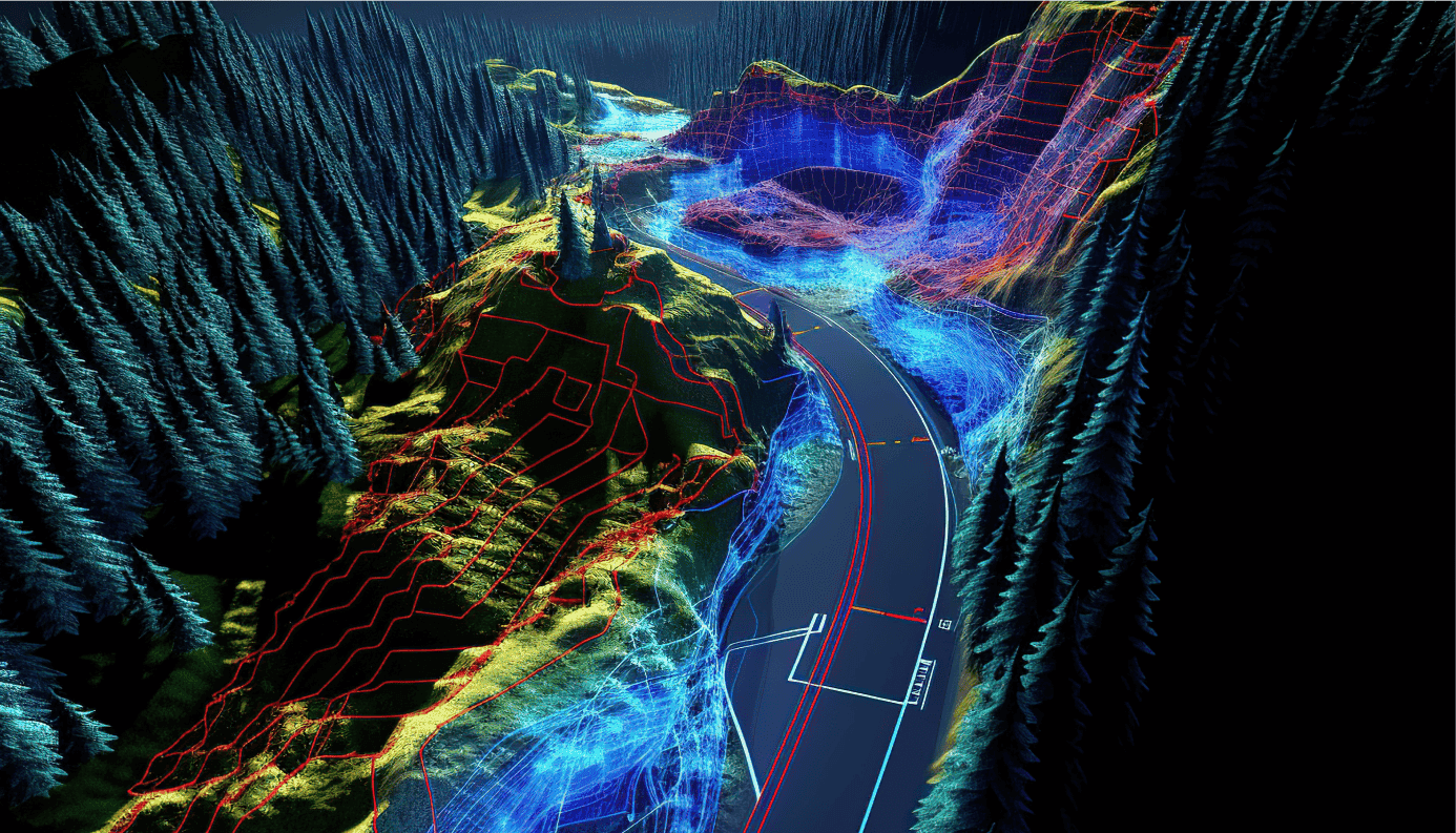
U.S.-based infrastructure development firm was tasked with managing a major highway project that involved extensive geotechnical investigations. The project required consolidating and interpreting approximately 350 boreholes and 600 trial pits from legacy records, along with 500 exploratory holes from current investigations. The main challenge was to digitize, integrate, and visualize this massive dataset for rapid, accurate decision-making.
Challenges
- Inconsistent Data Formats: Legacy records existed in varied formats, complicating standardization.
- High Data Volume: Processing large datasets from multiple sources created logistical challenges.
- Integration with 3D Models: Precise alignment of geotechnical data with highway geometry models was complex.
- Tight Deadlines: The project required quick turnaround for data visualization to support timely risk assessments.
Solution
To overcome these challenges, we implemented a multi-step, technology-driven approach:
- Data Digitization: Leveraged the in-house NetGraph system to convert paper-based borehole and trial pit records into standardized digital formats.
- Data Integration: Employed specialized integration platforms to merge legacy and current datasets into a unified database.
- 3D Model Alignment: Integrated geological sections with detailed 3D highway geometry models for enhanced spatial analysis.
- Automation: Developed custom automation scripts to instantly generate geological sections, drastically reducing manual processing time.
- Quality Assurance: Conducted multiple validation checks to ensure accuracy and completeness before final deployment.
Tech Stack
- Data Digitization Tools: In-house NetGraph system for converting paper-based geotechnical records into digital formats.
- Data Integration Platforms: Specialized software to merge and manage datasets from multiple sources.
- 3D Modeling Software: Integrated geological sections with highway geometry for enhanced spatial analysis.
- Automation Scripts: Custom scripts to automate geological section creation, reducing manual processing time drastically.
Business Impact
- Enhanced Efficiency: Geological sections generated in seconds, accelerating the planning and decision-making process.
- Cost Savings: Significant reduction in manual labor costs through automation.
- Improved Risk Assessment: Accurate, timely visualization of ground conditions for better project risk management.
- Increased Data Accessibility: Centralized, digitized datasets improved collaboration and access for all stakeholders.
Benefits
- 80-90% reduction in time required to generate geological sections.
- Up to 50% decrease in manual data processing costs.
- Seamless integration of legacy and current datasets into a single digital repository.
- Improved stakeholder collaboration through real-time data access and visual reporting.
Conclusion
Through advanced digitization, integration, and automation, the client successfully transformed a vast, fragmented dataset into a unified, accessible, and highly usable resource. This enabled faster, more informed decision-making, optimized resource utilization, and ensured the highway project could move forward with reduced risk and greater efficiency. The approach now serves as a benchmark for future infrastructure projects requiring rapid geotechnical data processing.