Consult With Us for Tailored Geospatial Solutions
12th Wonder considers the organization as a whole with the people, customers, business process, data and technology to drive the efficiency and effectiveness. As an experienced geospatial service provider, we implement the best practices to streamline your operations throughout the project life cycle. To enhance cross-cultural effectiveness, we provide training to individuals before their deployment to various geographies, covering both onsite and offsite practices.
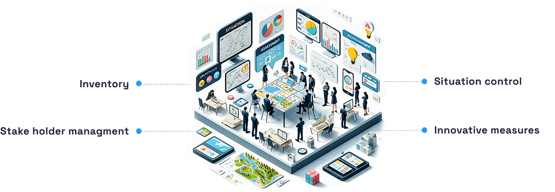
Situation Assessment
We assess the situation with the goal of completing processes in project inventory, outlining the project plan, and comprehending the customer’s perspective and innovation, offering a solution akin to the 12th wonder. The assessment identifies the capability of departmental units to respond for the stakeholder’s needs and the capacity of the stakeholder to benefit from the provided solution. The situation assessment identifies the need for geospatial practices, data inventory and maintenance, enterprise GIS framework, and required infrastructure services.

LiDAR Data & Processing Service
We are the maestros of LiDAR, orchestrating topographical data with rapid precision, day or night. Picture us as your digital surveyors, capturing both airborne and terrestrial/mobile LiDAR data with unparalleled quality. We map the heights with clarity, ensuring your landscape is a masterpiece of accuracy. Our Mapping Services Span Across:

Strategy Planning & Developments
At 12th Wonder, we strategize meticulously for project execution, taking a proactive stance in evaluating operational risks and adapting our manpower resources accordingly. Our methodology includes the implementation of robust processes, particularly in crafting tailor-made tools during project execution to precisely meet customer expectations. Moreover, we offer comprehensive training to project professionals, covering the project’s scope and deliverables, thereby enhancing their skill set.

Operations Planning
The operations plan should be crafted to bolster Program Design and amplify Geospatial integration across the organization. It ought to encompass practiced policies, organizational frameworks, training initiatives, as well as other essential processes and activities necessary to underpin the program design.

Implementation Planning
The implementation plan outlines the essential priorities and actions needed to realize the strategic plan, aligned with the program design and operations plan. It emphasizes both the necessary short-term and long-term accomplishments aimed at advancing the organization’s goal. In Addition, it details the required project implementation methodology for successful execution.

Here’s What We Offer for Your Staffing Services
We follow a meticulous process to deliver top-notch consulting services.
POC to Real Project Navigation
- Conduct thorough analysis of the proof of concept.
- Collaborate with clients to understand project requirements and objectives.
- Develop a detailed roadmap for transitioning from POC to a fully realized project.
Techno–Commercial Proposal Initiation
- Engage in strategic discussions to align technology solutions with business goals.
- Develop comprehensive techno-commercial proposals that outline project scope, timelines, and budget considerations
- Present proposals to clients, ensuring clarity and transparency in the decision-making process.
Quality Checks & Analysis
- Implement rigorous quality checks at every stage of the project lifecycle.
- Conduct detailed analysis to identify potential improvements and optimize geospatial solutions.
- Ensure that the final deliverables meet the highest standards of accuracy and reliability.
Consulting in Diverse Sectors
- Tailor our consulting services to address specific challenges and requirements in Utilities, Telecom, Defence, Urban Planning, Logistics, Mining, Transportation, Smart City, and Real Estate.
- Provide industry-specific insights and expertise to enhance the effectiveness of geospatial solutions.
Model Application Demos
- Develop interactive and engaging model application demos to showcase the potential of geospatial solutions.
- Customize demos based on client needs, allowing them to visualize the impact of our services.
- Gather feedback and refine the application demos for optimal user experience.
Onshore and Offshore App Development
- Leverage our skilled team of developers for onshore and offshore application development.
- Implement cutting-edge technologies to create web, mobile, desktop, and open-source applications.
- Ensure seamless integration and functionality across diverse platforms.
Data Services in Remote Sensing, GIS, LIDAR, Photogrammetry
- Offer specialized data services, including remote sensing, GIS, LiDAR, and photogrammetry.
- Collect, process, and analyze geospatial data to provide valuable insights for decision-making.
- Ensure the accuracy and reliability of data services to support clients’ geospatial initiatives.
Frequently Asked Questions
No, our GIS consulting services are designed to cater to a wide range of clients, including those without existing GIS infrastructure. Whether you are just starting with GIS implementation or looking to enhance your current systems, our consultants can guide you through the process, offering solutions that align with your current capabilities and future goals.


